
Kalpasar Project
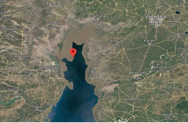
The Kalpasar Project or the Gulf of Khambhat Development Project envisages building a 30 km dam across the Gulf of Khambat in India for establishing a huge fresh water coastal reservoir for irrigation, drinking and industrial purposes. The project with 30 km sea dam will have the capacity to store 10 billion cubic meters fresh water, equating to 25% of Gujarat’s average annual rainwater flow, from the rivers like Narmada, Mahi, Dhadhar, Sabarmati, Limbdi-Bhagovo, and two other minor rivers. A 10 lane road link will also be set up over the dam, greatly reducing the distance between Saurashtra and South Gujarat. The project, which will create world's largest freshwater lake in marine environment, will cost INR90,000 crore or US$12.75 billion (2015-16 estimates with 8% annual inflation) excluding the cost of tidal power plant. Project entails construction of the main "Kalpasar dam" across Gulf of Khambat and another Bhadbhut barrage on Narmada river, as well as a canal connecting the two.
━━━━━━━━━━━━
🌞 @Gujarat 🦁
The Kalpasar Project or the Gulf of Khambhat Development Project envisages building a 30 km dam across the Gulf of Khambat in India for establishing a huge fresh water coastal reservoir for irrigation, drinking and industrial purposes. The project with 30 km sea dam will have the capacity to store 10 billion cubic meters fresh water, equating to 25% of Gujarat’s average annual rainwater flow, from the rivers like Narmada, Mahi, Dhadhar, Sabarmati, Limbdi-Bhagovo, and two other minor rivers. A 10 lane road link will also be set up over the dam, greatly reducing the distance between Saurashtra and South Gujarat. The project, which will create world's largest freshwater lake in marine environment, will cost INR90,000 crore or US$12.75 billion (2015-16 estimates with 8% annual inflation) excluding the cost of tidal power plant. Project entails construction of the main "Kalpasar dam" across Gulf of Khambat and another Bhadbhut barrage on Narmada river, as well as a canal connecting the two.
━━━━━━━━━━━━
🌞 @Gujarat 🦁
🔥2❤1👏1
Manekpore
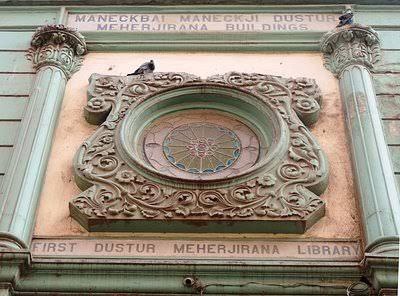
Manekpore - Rethvania is a village in the state of Gujarat in western India off Indian National Highway 8 pincode IS 396560 on Vansda Road from where you can travel to ahwa, via waghai, and vansda, and to the hill station of Saputara. The village population consists of Hindus and Muslims. Unofficial records state the population of this village is approximately 2,500. Many people from the village have emigrated abroad and have now settled in Africa, France (Overseas France not in the European metropole), Portugal and the United Kingdom.
━━━━━━━━━━━━
🌞 @Gujarat 🦁
Manekpore - Rethvania is a village in the state of Gujarat in western India off Indian National Highway 8 pincode IS 396560 on Vansda Road from where you can travel to ahwa, via waghai, and vansda, and to the hill station of Saputara. The village population consists of Hindus and Muslims. Unofficial records state the population of this village is approximately 2,500. Many people from the village have emigrated abroad and have now settled in Africa, France (Overseas France not in the European metropole), Portugal and the United Kingdom.
━━━━━━━━━━━━
🌞 @Gujarat 🦁
❤2🔥1👏1
Vadnagar
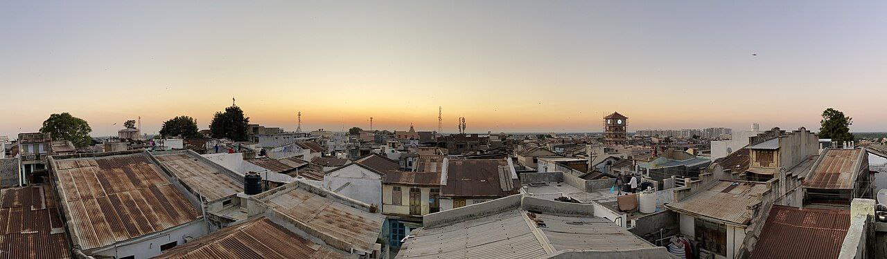
Vadnagar is a town and municipality in the Mehsana district of the state of Gujarat in India. It is located 35 km (22 mi) from Mehsana. Its ancient names include Anartapura (the capital of Anarta) and Anandapura. It was a location visited by Xuanzang in 640 C.E. The founder and the first Director-General of the Archaeological Survey of India (ASI), Alexander Cunningham, had identified Anandapura with the town of Vadnagar. Vadnagar is also the birthplace of Narendra Modi, the current Prime Minister of India. The archeological excavations presented sequence assigned from 4th-3rd century BCE to the present period.[3] Recent excavations, in six trenches, consider the beginning of the site to be around 800 BCE, (ca. 2754 calibrated years before present)
━━━━━━━━━━━━
🌞 @Gujarat 🦁
Vadnagar is a town and municipality in the Mehsana district of the state of Gujarat in India. It is located 35 km (22 mi) from Mehsana. Its ancient names include Anartapura (the capital of Anarta) and Anandapura. It was a location visited by Xuanzang in 640 C.E. The founder and the first Director-General of the Archaeological Survey of India (ASI), Alexander Cunningham, had identified Anandapura with the town of Vadnagar. Vadnagar is also the birthplace of Narendra Modi, the current Prime Minister of India. The archeological excavations presented sequence assigned from 4th-3rd century BCE to the present period.[3] Recent excavations, in six trenches, consider the beginning of the site to be around 800 BCE, (ca. 2754 calibrated years before present)
━━━━━━━━━━━━
🌞 @Gujarat 🦁
🔥2❤1👍1
Dabhoi
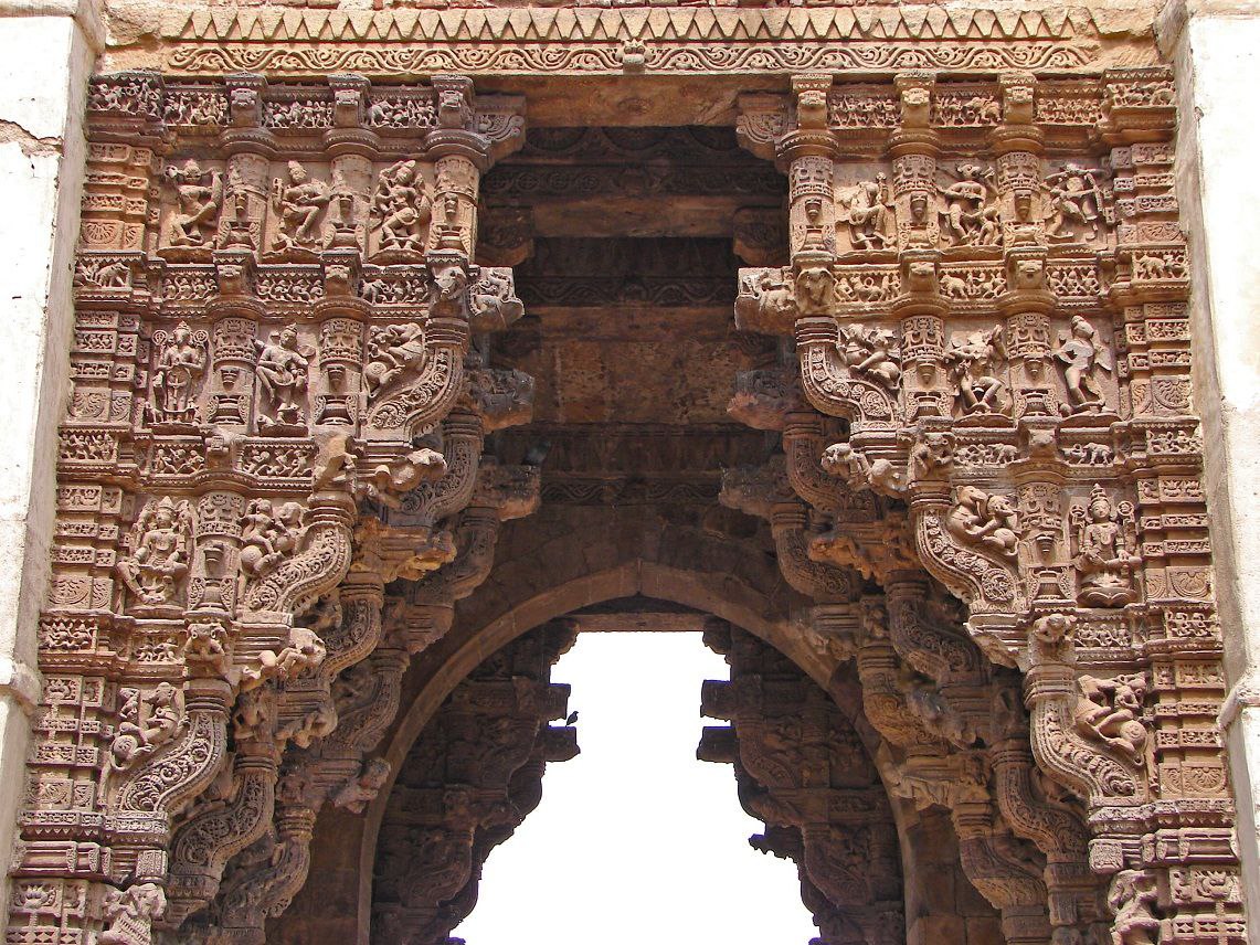
Dabhoi is a town and a municipality in the Vadodara district in the state of Gujarat, India. Dabhoi has a big popular sunni masjid (mosque) named Kaziwad Masjid. Dabhoi was historically known as Darbhavati, Darbikagrama, Darbhavatipura, and Dabhohi. It is first mentioned in the sixth century astronomical treatise Romaka Siddhanta. It was an important pilgrim site for Hindus due to the Kalika temple and for Jains as well. It is also mentioned in several Jain works, such as Hemachandra's Yogartrevritti and Ramchandra's Vikramcharitra. The town and its surroundings were under Chavda and later under Chaulukya rulers who built few buildings and temples from the ninth century.
━━━━━━━━━━━━
🌞 @Gujarat 🦁
Dabhoi is a town and a municipality in the Vadodara district in the state of Gujarat, India. Dabhoi has a big popular sunni masjid (mosque) named Kaziwad Masjid. Dabhoi was historically known as Darbhavati, Darbikagrama, Darbhavatipura, and Dabhohi. It is first mentioned in the sixth century astronomical treatise Romaka Siddhanta. It was an important pilgrim site for Hindus due to the Kalika temple and for Jains as well. It is also mentioned in several Jain works, such as Hemachandra's Yogartrevritti and Ramchandra's Vikramcharitra. The town and its surroundings were under Chavda and later under Chaulukya rulers who built few buildings and temples from the ninth century.
━━━━━━━━━━━━
🌞 @Gujarat 🦁
🔥2❤1👏1
3rd Narmada Bridge
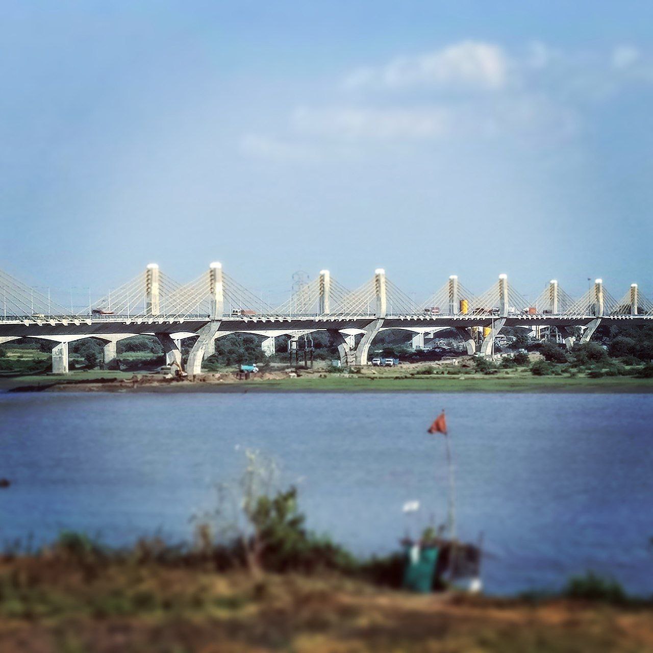
The New Narmada Bridge (or the 3rd Narmada Bridge) is an extra dosed bridge, constructed at Bharuch, India. It is a 1,344 m (4,409 ft) long bridge, built over river Narmada on NH-8. The four-lane bridge is a part of larger project involving six laning of a section of NH-8 between Vadodara and Surat. It runs parallel to Sardar Bridge. It is the extradosed bridge with the longest spans in India, 144 m (472 ft) long. The bridge was constructed by Larsen & Toubro and Dywidag Systems International (DSI-Bridgecon). The estimated cost of bridge is ₹379 crore (equivalent to ₹532 crore or US$63 million in 2023). This bridge was inaugurated by Indian Prime Minister Narendra Modi on 7 March 2017. A few months later in June 2017, the Arrah–Chhapra Bridge opened and became the longest multi-span extradosed bridge in the world, with a main bridge length of 1,920 m (6,300 ft). Even so, the 3rd Narmada Bridge remains the extradosed bridge with the longest spans in India.
━━━━━━━━━━━━
🌞 @Gujarat 🦁
The New Narmada Bridge (or the 3rd Narmada Bridge) is an extra dosed bridge, constructed at Bharuch, India. It is a 1,344 m (4,409 ft) long bridge, built over river Narmada on NH-8. The four-lane bridge is a part of larger project involving six laning of a section of NH-8 between Vadodara and Surat. It runs parallel to Sardar Bridge. It is the extradosed bridge with the longest spans in India, 144 m (472 ft) long. The bridge was constructed by Larsen & Toubro and Dywidag Systems International (DSI-Bridgecon). The estimated cost of bridge is ₹379 crore (equivalent to ₹532 crore or US$63 million in 2023). This bridge was inaugurated by Indian Prime Minister Narendra Modi on 7 March 2017. A few months later in June 2017, the Arrah–Chhapra Bridge opened and became the longest multi-span extradosed bridge in the world, with a main bridge length of 1,920 m (6,300 ft). Even so, the 3rd Narmada Bridge remains the extradosed bridge with the longest spans in India.
━━━━━━━━━━━━
🌞 @Gujarat 🦁
🔥2❤1👏1
Jhulasan
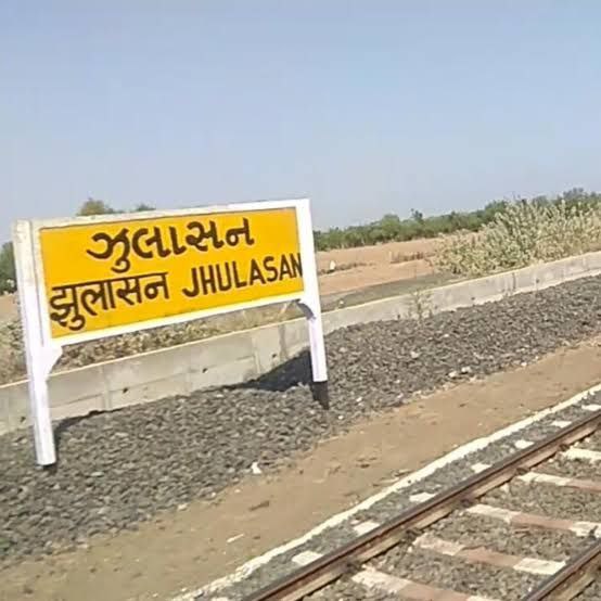
Jhulasan (Gujarati: ઝુલાસણ Jhulāsaṇ) is a small village located in district of Mehsana, Kadi Taluka in the state of Gujarat, India. According to Hasmukh Dhirajlal Sankalia, the name Jhulāsaṇ may be identical to the Kūlāvasaṇa mentioned in medieval epigraphy. Assuming this is the case, then the name is ultimately derived from Sanskrit vasaṇa, meaning "dwelling" or "residence" (of either an individual or a group).[1]: 69–70 There is another belief that some travelers were going from one place to another and decided to rest at this place and made Jula, (swing hanging from the branch of a tree) and liked the place and decided to settle down so they gave the name of this place Jhulasan.
━━━━━━━━━━━━
🌞 @Gujarat 🦁
Jhulasan (Gujarati: ઝુલાસણ Jhulāsaṇ) is a small village located in district of Mehsana, Kadi Taluka in the state of Gujarat, India. According to Hasmukh Dhirajlal Sankalia, the name Jhulāsaṇ may be identical to the Kūlāvasaṇa mentioned in medieval epigraphy. Assuming this is the case, then the name is ultimately derived from Sanskrit vasaṇa, meaning "dwelling" or "residence" (of either an individual or a group).[1]: 69–70 There is another belief that some travelers were going from one place to another and decided to rest at this place and made Jula, (swing hanging from the branch of a tree) and liked the place and decided to settle down so they gave the name of this place Jhulasan.
━━━━━━━━━━━━
🌞 @Gujarat 🦁
🔥2❤1👏1
Mahemadavad Kheda Road railway station
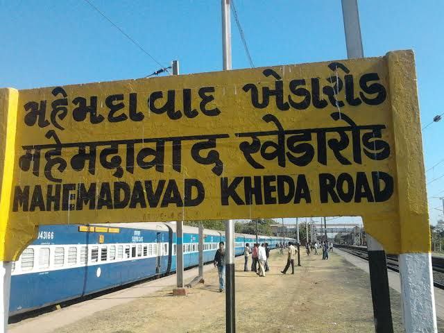
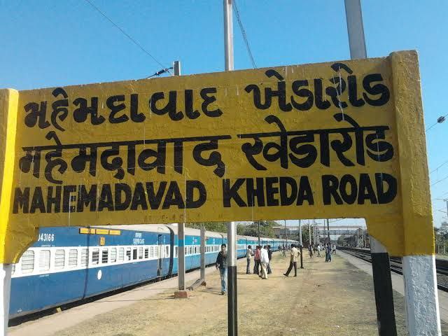
Mahemadavad Kheda Road railway station is a railway station on the Western Railway network in the state of Gujarat, India. This Station Connects to Kheda City and Mahemdavad Town. Mhemadavad Kheda Road railway station is 18km from Nadiad railway station. Passenger, MEMU, and a few Express/Superfast trains halt at Mahemadavad Kheda Road railway station. This railway station's nearest city is Kheda. The railway station's name is Mahemadavad Kheda Road because the railway station is located near Mahemadavad – Kheda Road of Mahemadavad. Mahemadavad - Kheda Road connects Kheda and Mahemadavad.
━━━━━━━━━━━━
🌞 @Gujarat 🦁
Mahemadavad Kheda Road railway station is a railway station on the Western Railway network in the state of Gujarat, India. This Station Connects to Kheda City and Mahemdavad Town. Mhemadavad Kheda Road railway station is 18km from Nadiad railway station. Passenger, MEMU, and a few Express/Superfast trains halt at Mahemadavad Kheda Road railway station. This railway station's nearest city is Kheda. The railway station's name is Mahemadavad Kheda Road because the railway station is located near Mahemadavad – Kheda Road of Mahemadavad. Mahemadavad - Kheda Road connects Kheda and Mahemadavad.
━━━━━━━━━━━━
🌞 @Gujarat 🦁
❤1🔥1👏1
Udhna
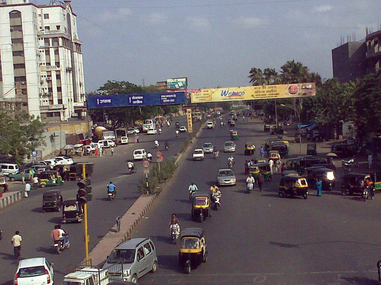
Udhna (Also Called Udhana) is a Suburban area of Surat, located primarily on Surat-Navsari Highway in the Indian state of Gujarat.[1] Udhna is an Industrial Area in city of Surat, India. It is about 9 km from Surat central Railway Station and 14 km from Surat Airport. As of the 2001 census, Udhna had a population of 407,970. Males constitute 63% of the population and females 37%. Udhna has an average literacy rate of 74%, higher than the national average of 59.5%. Male literacy is 81%, and female literacy is 63%. In Udhna, 14% of the population is under 6 years of age.
━━━━━━━━━━━━
🌞 @Gujarat 🦁
Udhna (Also Called Udhana) is a Suburban area of Surat, located primarily on Surat-Navsari Highway in the Indian state of Gujarat.[1] Udhna is an Industrial Area in city of Surat, India. It is about 9 km from Surat central Railway Station and 14 km from Surat Airport. As of the 2001 census, Udhna had a population of 407,970. Males constitute 63% of the population and females 37%. Udhna has an average literacy rate of 74%, higher than the national average of 59.5%. Male literacy is 81%, and female literacy is 63%. In Udhna, 14% of the population is under 6 years of age.
━━━━━━━━━━━━
🌞 @Gujarat 🦁
🔥2❤1👏1
Canara Coffee House
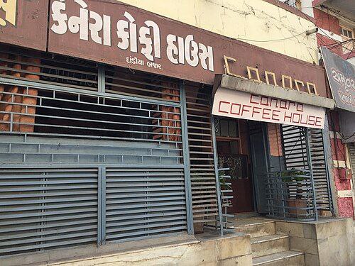
Canara Coffee House, established between 1945 and 1957, is the oldest café in Vadodara, Gujarat, known for its iconic Poona Misal—a unique dish that combines rice flakes, steamed lentils, and yogurt topped with crunchy chiwda. Founded by Vasant Rao Mahale, a native of Pune who moved to Vadodara in 1940, the coffee house serves a variety of traditional South Indian and Maharashtrian dishes, including dosas, uthappams, batata vada, upma, and pineapple sheera. Despite relocating and modernizing its premises after the original building was demolished in 2016, Canara Coffee House has preserved its nostalgic charm through vintage décor elements like an old wall clock, a Philips radio, and a traditional telephone. The café remains a popular spot for college students, families, and locals due to its affordable menu and warm, humble service. Today, managed by Rajesh Kudva and his wife Gauri, this establishment continues to be a beloved institution in Vadodara's food culture, serving both celebrities and everyday patrons with a cozy and simple ambiance that reflects the spirit of old Vadodara.
━━━━━━━━━━━━
🌞 @Gujarat 🦁
Canara Coffee House, established between 1945 and 1957, is the oldest café in Vadodara, Gujarat, known for its iconic Poona Misal—a unique dish that combines rice flakes, steamed lentils, and yogurt topped with crunchy chiwda. Founded by Vasant Rao Mahale, a native of Pune who moved to Vadodara in 1940, the coffee house serves a variety of traditional South Indian and Maharashtrian dishes, including dosas, uthappams, batata vada, upma, and pineapple sheera. Despite relocating and modernizing its premises after the original building was demolished in 2016, Canara Coffee House has preserved its nostalgic charm through vintage décor elements like an old wall clock, a Philips radio, and a traditional telephone. The café remains a popular spot for college students, families, and locals due to its affordable menu and warm, humble service. Today, managed by Rajesh Kudva and his wife Gauri, this establishment continues to be a beloved institution in Vadodara's food culture, serving both celebrities and everyday patrons with a cozy and simple ambiance that reflects the spirit of old Vadodara.
━━━━━━━━━━━━
🌞 @Gujarat 🦁
❤3🔥2👏1
Chhaya
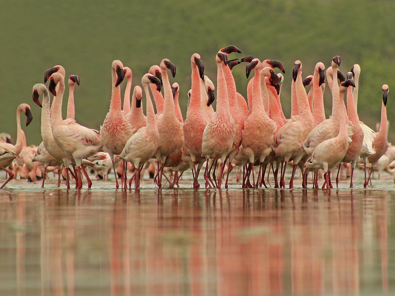
Chhaya is a city and a Municipal corporation in Porbandar district in the state of Gujarat, India. Chhaya and Porbandar are the twin cities of each other and both cities are jointly governed by Porbandar–Chhaya Municipal Corporation. Chhaya is situated on the west bank of the Porbandar creek and the Mokal Ran lies to the west of it. It was the Jethva capital after the abandonment of Ranpur and previous to the adoption of Porbandar, and the old palace is still there.
Jethwas are from Chhaya village. The Jethwas have had capitals at starting with Morvi in 900 AD, changing with times to Shrinagar, Dhank, Chhaya, Ghumli, Ranpur and lastly to Porbandar (from 1685 till 1947).
━━━━━━━━━━━━
🌞 @Gujarat 🦁
Chhaya is a city and a Municipal corporation in Porbandar district in the state of Gujarat, India. Chhaya and Porbandar are the twin cities of each other and both cities are jointly governed by Porbandar–Chhaya Municipal Corporation. Chhaya is situated on the west bank of the Porbandar creek and the Mokal Ran lies to the west of it. It was the Jethva capital after the abandonment of Ranpur and previous to the adoption of Porbandar, and the old palace is still there.
Jethwas are from Chhaya village. The Jethwas have had capitals at starting with Morvi in 900 AD, changing with times to Shrinagar, Dhank, Chhaya, Ghumli, Ranpur and lastly to Porbandar (from 1685 till 1947).
━━━━━━━━━━━━
🌞 @Gujarat 🦁
❤3🔥2👏2
Shetrunji
Shetrunji River (alternate: Satrunji) is an Eastward-flowing river from Gir to Gulf of Khambhat in Bhavnagar, Gujarat, in western India. It rises northeast of the Gir Hills, near Dhari in Amreli district. Its course begins east-northeast along a lineament which runs parallel to the Narmada Fault, passes north of Palitana's hills, Shatrunjaya, then in a southeasterly direction past Talaja Hill, through a peninsula, before reaching the Gulf of Cambay, approximately 6 miles (9.7 km) north of Goapnath Point. It has two mouths, one situated approximately 4.5 miles (7.2 km) north of the point, and the other being an additional 1.5 miles (2.4 km) to the north. Situated 4.5 miles (7.2 km) eastward of the river's mouth is Sultanpur Shoal. Shetrunji's basin has a maximum length of 227 kilometres (141 mi). The total catchment area of the basin is 5,636 square kilometres (2,176 sq mi). Along with the Ghelo, Kalubhar, and the Vagad Rivers, the Shetrunji is a principal river of the district, and the second largest river in the region of Saurashtra. The brackish stream, Gagadio, joins the Shetrunji about 2 kilometres (1.2 mi) from Krankach. Khodiyar Mata is an approximately 50 feet (15 m) waterfall near Dhari. The topography is a mix of hills and plains.
━━━━━━━━━━━━
🌞 @Gujarat 🦁
Shetrunji River (alternate: Satrunji) is an Eastward-flowing river from Gir to Gulf of Khambhat in Bhavnagar, Gujarat, in western India. It rises northeast of the Gir Hills, near Dhari in Amreli district. Its course begins east-northeast along a lineament which runs parallel to the Narmada Fault, passes north of Palitana's hills, Shatrunjaya, then in a southeasterly direction past Talaja Hill, through a peninsula, before reaching the Gulf of Cambay, approximately 6 miles (9.7 km) north of Goapnath Point. It has two mouths, one situated approximately 4.5 miles (7.2 km) north of the point, and the other being an additional 1.5 miles (2.4 km) to the north. Situated 4.5 miles (7.2 km) eastward of the river's mouth is Sultanpur Shoal. Shetrunji's basin has a maximum length of 227 kilometres (141 mi). The total catchment area of the basin is 5,636 square kilometres (2,176 sq mi). Along with the Ghelo, Kalubhar, and the Vagad Rivers, the Shetrunji is a principal river of the district, and the second largest river in the region of Saurashtra. The brackish stream, Gagadio, joins the Shetrunji about 2 kilometres (1.2 mi) from Krankach. Khodiyar Mata is an approximately 50 feet (15 m) waterfall near Dhari. The topography is a mix of hills and plains.
━━━━━━━━━━━━
🌞 @Gujarat 🦁

🔥2👏1😱1
Banas River
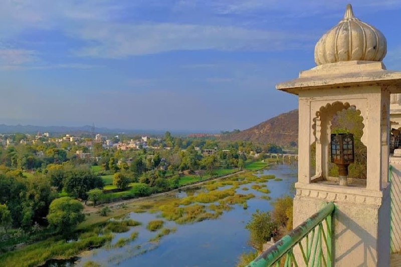
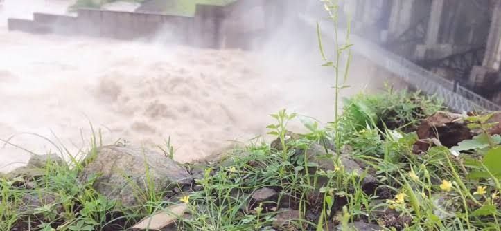
The mighty Banas River flows with tremendous force through northern Gujarat, creating a landscape that’s both rugged and beautiful. This powerful waterway has carved deep valleys and supported civilizations for thousands of years. The river’s seasonal variations make it an interesting study for nature enthusiasts and researchers alike.
Banas holds special importance for wildlife conservation, as its banks provide habitat for various species of birds and animals. The best time to visit Gujarat for experiencing Banas in its full glory is during the post-monsoon period when the river flows steadily and the surrounding vegetation is at its greenest. Local folklore is filled with stories about this river, making every visit a journey through Gujarat’s cultural memory.
━━━━━━━━━━━━
🌞 @Gujarat 🦁
The mighty Banas River flows with tremendous force through northern Gujarat, creating a landscape that’s both rugged and beautiful. This powerful waterway has carved deep valleys and supported civilizations for thousands of years. The river’s seasonal variations make it an interesting study for nature enthusiasts and researchers alike.
Banas holds special importance for wildlife conservation, as its banks provide habitat for various species of birds and animals. The best time to visit Gujarat for experiencing Banas in its full glory is during the post-monsoon period when the river flows steadily and the surrounding vegetation is at its greenest. Local folklore is filled with stories about this river, making every visit a journey through Gujarat’s cultural memory.
━━━━━━━━━━━━
🌞 @Gujarat 🦁
🔥2❤1👏1
Ukai Thermal Power Station
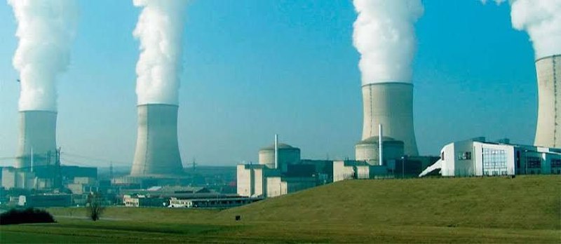
Ukai Thermal Power Station of the Gujarat State Electricity Corporation Limited, India, is a power station with an installed capacity of 1,110 MW. It is one of Gujarat's major coal-fired power plants, located on the bank of the Tapi river. Ukai Thermal Power Station is located on the banks of the Tapi because of the water resources, along with the hydroelectric power plant with the same name. Ukai TPS Unit-1 is the first power station unit in India with a capacity more than 100 MW.
━━━━━━━━━━━━
🌞 @Gujarat 🦁
Ukai Thermal Power Station of the Gujarat State Electricity Corporation Limited, India, is a power station with an installed capacity of 1,110 MW. It is one of Gujarat's major coal-fired power plants, located on the bank of the Tapi river. Ukai Thermal Power Station is located on the banks of the Tapi because of the water resources, along with the hydroelectric power plant with the same name. Ukai TPS Unit-1 is the first power station unit in India with a capacity more than 100 MW.
━━━━━━━━━━━━
🌞 @Gujarat 🦁
👏3❤1🔥1
🎈Is your english not as good as you wish it should be?
🎈Do you want to practice english but can't due to various circumstances?
🎈 Do you wish to learn english in a fun and easy manner?
📫 To solve the above issues join us and start learning
https://t.me/chatting
▶️ Join @Chatting
🚨 Rules for chatting 🚨
🎈Do you want to practice english but can't due to various circumstances?
🎈 Do you wish to learn english in a fun and easy manner?
📫 To solve the above issues join us and start learning
https://t.me/chatting
▶️ Join @Chatting
🚨 Rules for chatting 🚨
Mahemadavad Kheda Road railway station
Mahemadavad Kheda Road railway station is a railway station on the Western Railway network in the state of Gujarat, India.[1] This Station Connects to Kheda City and Mahemdavad Town. Mhemadavad Kheda Road railway station is 18km from Nadiad railway station. Passenger, MEMU, and a few Express/Superfast trains halt at Mahemadavad Kheda Road railway station. This railway station's nearest city is Kheda. Mahemadavad is well known for Shri Siddhivinayak Devsthan, situated near the bank of the Vatrak River
━━━━━━━━━━━━
🌞 @Gujarat 🦁
Mahemadavad Kheda Road railway station is a railway station on the Western Railway network in the state of Gujarat, India.[1] This Station Connects to Kheda City and Mahemdavad Town. Mhemadavad Kheda Road railway station is 18km from Nadiad railway station. Passenger, MEMU, and a few Express/Superfast trains halt at Mahemadavad Kheda Road railway station. This railway station's nearest city is Kheda. Mahemadavad is well known for Shri Siddhivinayak Devsthan, situated near the bank of the Vatrak River
━━━━━━━━━━━━
🌞 @Gujarat 🦁
❤3🔥3👏1
Saldi
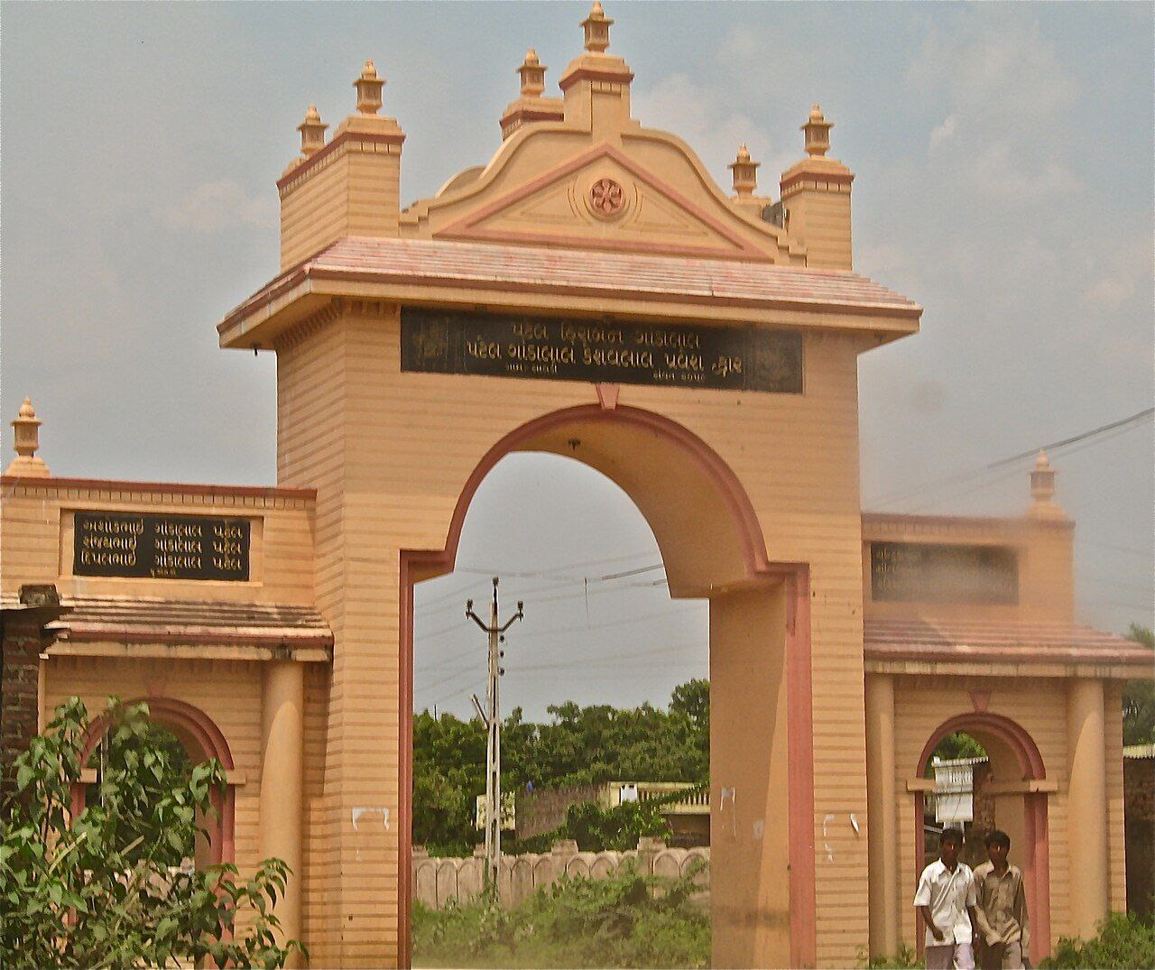
Saldi is a village in the Mehsana District, Gujarat, India, Pin Code 382730, situated on State Highway 217 between Gandhinagar and Mehsana. Saldi represents a typical countryside village of India. It borders the following villages: langhnaj, Veda, Parsa, Charadu, Vadasma, Shankarpura, Khata Amba, Khoraj and Himatpura. Saldi is famous for its temple of Pimpleshwar Mahadev, also known as Saldiya Mahadev. The nearest railway stations are Kalol which is located 25 km and Mehsana 26 km from Saldi. Sardar Patel International Airport - Ahmedabad is about 50 km from Saldi.
━━━━━━━━━━━━
🌞 @Gujarat 🦁
Saldi is a village in the Mehsana District, Gujarat, India, Pin Code 382730, situated on State Highway 217 between Gandhinagar and Mehsana. Saldi represents a typical countryside village of India. It borders the following villages: langhnaj, Veda, Parsa, Charadu, Vadasma, Shankarpura, Khata Amba, Khoraj and Himatpura. Saldi is famous for its temple of Pimpleshwar Mahadev, also known as Saldiya Mahadev. The nearest railway stations are Kalol which is located 25 km and Mehsana 26 km from Saldi. Sardar Patel International Airport - Ahmedabad is about 50 km from Saldi.
━━━━━━━━━━━━
🌞 @Gujarat 🦁
❤2👍2🔥1
Vatrak River
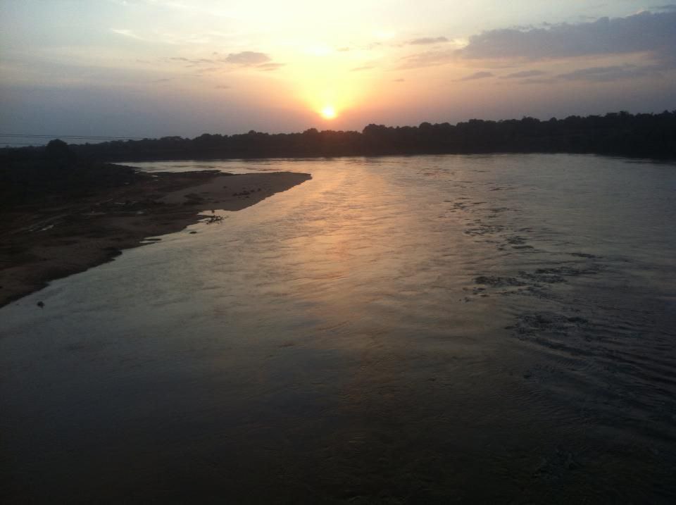
The Vatrak is a tributary of the Sabarmati River which flows for 243 kilometers in Gujarat, India. It originates in the hills of Dungarpur, Rajasthan and enters in Gujarat near village Moydi of Meghraj taluka. Vatrak run parallel to the Mahi River,[2] for about 29 km in Rajasthan, before entering the Sabarkantha district near village Moyedi.[citation needed] It runs in the southwest direction of the district, joining Mazum river near the district border with Kheda. Near Untadiya village, Vatrak river meets Zanzari river and the Utkanteshwar Mahadev temple is located on the sangam.
━━━━━━━━━━━━
🌞 @Gujarat 🦁
The Vatrak is a tributary of the Sabarmati River which flows for 243 kilometers in Gujarat, India. It originates in the hills of Dungarpur, Rajasthan and enters in Gujarat near village Moydi of Meghraj taluka. Vatrak run parallel to the Mahi River,[2] for about 29 km in Rajasthan, before entering the Sabarkantha district near village Moyedi.[citation needed] It runs in the southwest direction of the district, joining Mazum river near the district border with Kheda. Near Untadiya village, Vatrak river meets Zanzari river and the Utkanteshwar Mahadev temple is located on the sangam.
━━━━━━━━━━━━
🌞 @Gujarat 🦁
👍2❤1👏1
Bhavnagar Thermal Power Station
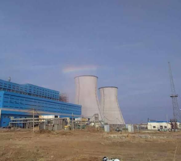
Bhavnagar Thermal Power Station or Padva Thermal Power Station is a coal-based thermal power plant located in Padva village near Ghogha town in Bhavnagar district, Gujarat. The power plant is owned by Bhavnagar Energy Company Limited. Bharat Heavy Electricals is executing the project.
━━━━━━━━━━━━
🌞 @Gujarat 🦁
Bhavnagar Thermal Power Station or Padva Thermal Power Station is a coal-based thermal power plant located in Padva village near Ghogha town in Bhavnagar district, Gujarat. The power plant is owned by Bhavnagar Energy Company Limited. Bharat Heavy Electricals is executing the project.
━━━━━━━━━━━━
🌞 @Gujarat 🦁
🔥3❤1👏1
Shatrunjaya
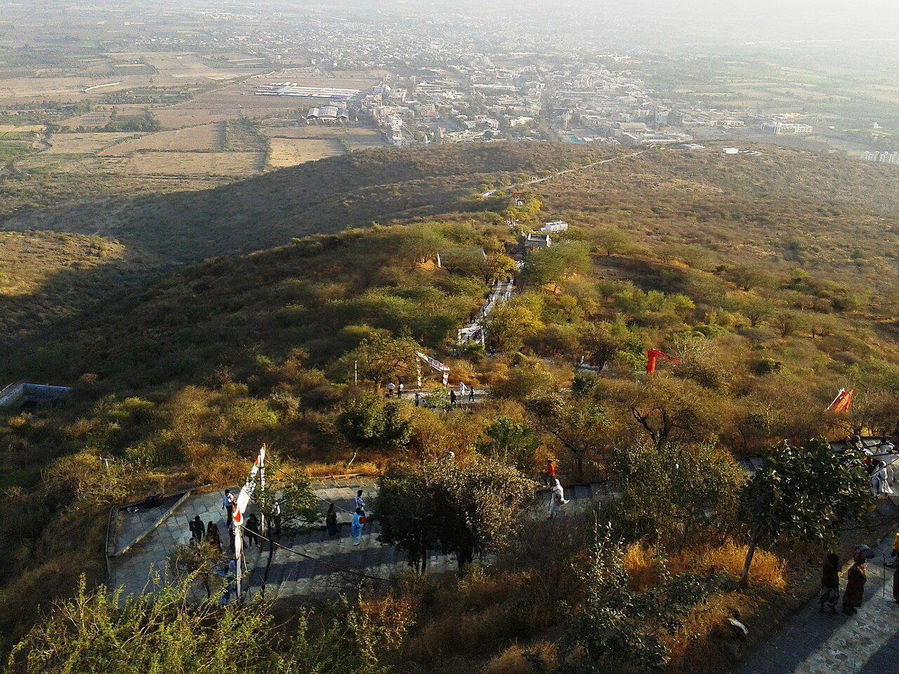
Shatrunjaya, also spelled Shetrunjaya ("place of victory against inner enemies") and originally known as Pundarikgiri, is a range of hills located near the city of Palitana in the Bhavnagar district of Gujarat, India. The hills are situated on the banks of the Shetrunji River at an elevation of approximately 164 feet (50 m) above sea level. These hills bear similarities to other locations where Jain temples have been constructed, including those in Bihar, Gwalior, Mount Abu, and Girnar.
━━━━━━━━━━━━
🌞 @Gujarat 🦁
Shatrunjaya, also spelled Shetrunjaya ("place of victory against inner enemies") and originally known as Pundarikgiri, is a range of hills located near the city of Palitana in the Bhavnagar district of Gujarat, India. The hills are situated on the banks of the Shetrunji River at an elevation of approximately 164 feet (50 m) above sea level. These hills bear similarities to other locations where Jain temples have been constructed, including those in Bihar, Gwalior, Mount Abu, and Girnar.
━━━━━━━━━━━━
🌞 @Gujarat 🦁
🔥2❤1👏1